Measure
Measure, analyse, and interpret crucial aspects of your project environment. From elevation and volumetric assessments to operational efficiency checks and advanced thermography, the resources presented here empower you to make informed decisions. By combining precise data with intuitive visualisations, you can enhance productivity, maintain compliance, and optimise both safety and performance.
Elevation
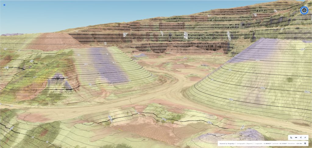
Gain a clearer understanding of the heights and slopes that define your project site. Our elevation tools help you inspect individual points, compare ground levels against planned designs, and track changes between survey sessions. This ensures you maintain confidence in your data, make informed decisions about grading, and anticipate challenges before they arise.
Spot Height
Accurately identify the elevation of specific points on your site. By selecting any location within your digital environment, you can extract precise height values. This simple but effective tool allows you to validate site conditions, support engineering calculations, and confirm compliance with design specifications.
Cross Sections
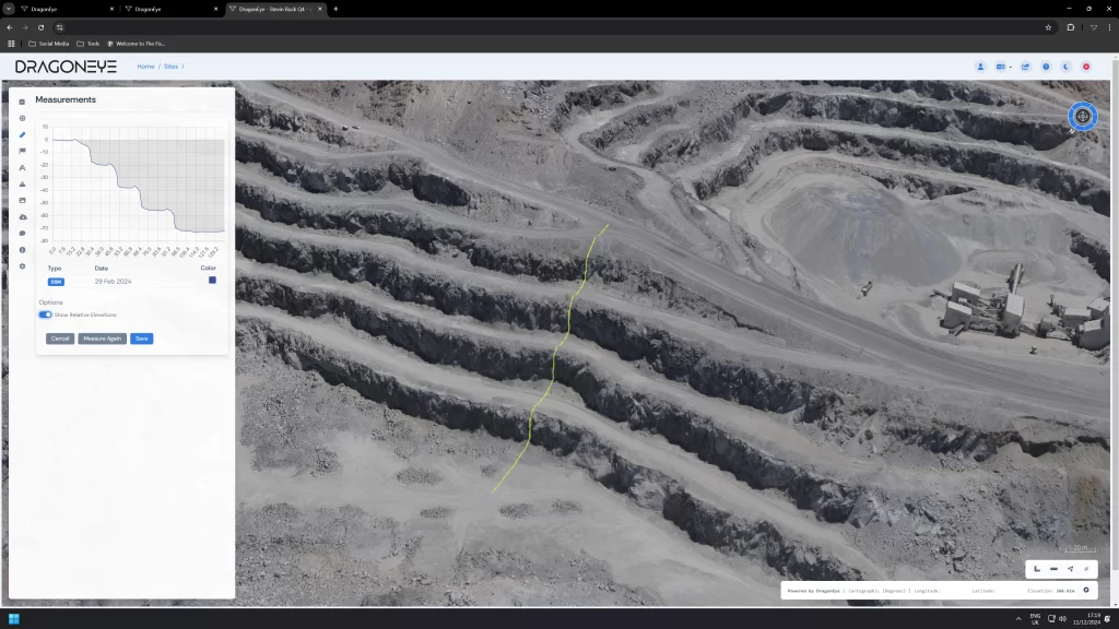
Accurately identify the elevation of specific points on your site. By selecting any location within your digital environment, you can extract precise height values. This simple but effective tool allows you to validate site conditions, support engineering calculations, and confirm compliance with design specifications.
Volumetric & Material
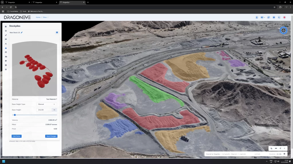
Make informed decisions about material management, stockpile inventories, and excavation projects. Our volumetric tools help you quantify the amount of earth or aggregate present, while keeping track of movements and transformations. Use these insights to minimise waste, control costs, and maintain progress in line with design and safety standards.
Volume
Quickly measure the total amount of material in a stockpile, excavation, or fill area. By relying on precise calculations rather than estimates, you gain a factual basis for resource planning, budgeting, and operational forecasting. With accurate volume assessments, you can improve allocation, reduce unnecessary purchasing, and keep stakeholders fully informed.
Cut & Fill
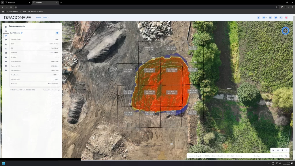
Identify where material needs to be removed, added, or redistributed to achieve the desired ground profile. By comparing surveyed conditions against the design plan, our cut and fill analysis highlights exactly where adjustments are needed. Optimising these movements helps you maintain project schedules, reduce fuel usage, and adhere to environmental guidelines.

Efficiency & Compliance
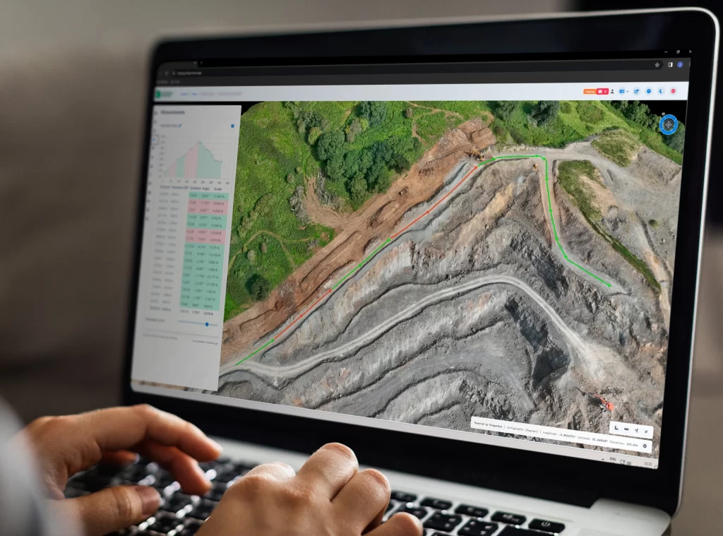
Enhance the productivity and safety of your operations by monitoring and analysing key operational factors. Our platform provides tools to check roadway gradients, identify potential hazards, and verify that protective measures meet required standards. In doing so, you can streamline daily tasks, reduce incident risks, and ensure you are always working within the parameters set by authorities and best practice.
Road Grade
Assess the slope of internal roads and haul routes to ensure that vehicles run smoothly and efficiently. By understanding gradients and making timely adjustments, you can improve fuel economy, reduce wear on machinery, and maintain safer travel conditions across your site. The resulting gains in efficiency translate to reduced overheads and a smoother workflow.
Health & Safety
Safeguard your workforce and equipment through targeted assessments of critical features. Whether it is monitoring the height of protective bunds, verifying rock trap capacity, or ensuring structures meet regulatory requirements, our measurements help you detect and address issues before they lead to costly incidents. Making health and safety a priority not only protects personnel and assets but also strengthens your reputation as a responsible operator.
Thermography
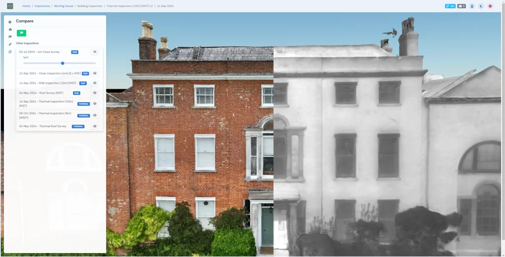
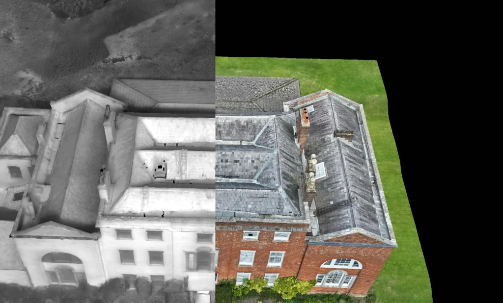
By capturing infrared data, our platform highlights subtle temperature variations that can indicate inefficiencies, emerging maintenance needs, or potential safety concerns. With these insights, you can address issues proactively, optimise energy usage, and maintain consistent performance across your site.
Thermal Modelling
Create accurate representations of heat distribution throughout your infrastructure. Thermal modelling helps you predict maintenance requirements, inform design improvements, and make evidence based decisions that extend the operational life of critical assets.
Thermal Media
Experience the power of thermal imagery and video to visualise temperature patterns and pinpoint problem areas. These compelling visuals enhance communication among stakeholders, guide corrective actions, and reinforce your commitment to maintaining a safe, efficient environment.